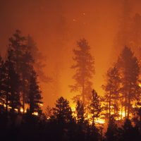
Central Oregon – Firefighters are responding to two new incidents in Central Oregon today, including a 200 acre fire burning near the South Fork of the John Day. Gusty winds are expected along the Cascade crest today, which will challenge firefighting suppression efforts.
The Green Ridge Fire remains an estimated 500 acres burning on the Deschutes National Forest and private land protected by the Oregon Department of Forestry with 5% containment this morning. A Type 2 Incident Management Team has taken command of the fire as of 6:00 a.m. this morning. An area closure will soon be put in place for the safety of the public and firefighter working in the area. There are no evacuations at this time.
Update: Jefferson County, Oregon – The Green Ridge fire started on August 16 approximately 12 miles
northwest of Sisters, Oregon. The Central Oregon Fire Management Services Team (COFMS), a local
Type 3 Team, has been managing initial attack operations since the fire began. The fire continues to burn
in mixed conifers and sagebrush. High temperatures and afternoon winds yesterday caused spotting across
the eastern edge of the fire, and the fire grew to approximately 1,013 acres.
At 6:00 a.m. today, an Interagency Incident Management Team (NW Team 10) from the Pacific
Northwest (Alan Lawson, Incident Commander) assumed management of the fire. Fire operations will
focus on scouting for line locations and begin construction of direct and indirect fire line. Suppression
priorities include stopping the spread of the fire into private timberland to the east and establishing and
holding containment lines on the west where the fire has backed down into the Metolius Basin. More than
170 firefighting personnel are assigned to the Green Ridge Fire. Challenges remain high temperatures and
low relative humidity, afternoon winds, and steep slopes on the western edge of the fire.
Three helicopters are assigned to the Green Ridge Fire. With limited flight time each day, these resources
are used to support ground resources during the most critical time of the day when the fire is most active.
A temporary flight restriction (TFR) is in place over the Green Ridge Fire area, restricting public access
for aircraft including drones. Any time a drone is sighted within the TFR, air operations are grounded.
Our highest priority is the safety of the public and all wildland fire personnel. In coordination with local
partners, state and federal fire agencies, the Wildland Fire Response Plan (WFRP) was developed to help
protect firefighters and the public during the COVID-19 pandemic. To keep firefighters and communities
healthy and safe during the Green Ridge Fire, all fire personnel are expected to follow recommendations
from the Centers for Disease Control and Prevention (CDC). This includes limiting public access to the
Incident Command Post (ICP) at Sisters Middle School. While COVID-19 circumstances are rapidly
evolving, and federal agency guidance continues to adapt with the situation, NW Team 10 is prepared for
wildland fire activity during this time.
The Deschutes National Forest is establishing area and road closures for the Green Ridge Fire today and a
map and description of the closure area will be posted to Inciweb as soon as it is available.
There was minimal growth on the Lily Fire in the Charlton Roadless Area on the Deschutes National Forest (DNF) last night. It remains an estimated 30 acres with 10% containment. With forecasted winds, firefighters will be challenged with increased fire behavior today on this fire which is burning in the 1996 Charlton Fire scar and into nearby heavy timber. Officials will be putting into place an area closure for the safety of the public and firefighters working in the area that will include some portions of the Pacific Crest Trail.
The Frog Fire in the Maury Mountains on the Ochoco National Forest east of Prineville is now estimated to be 50 acres with no containment. A Type 3 Incident Management Team has taken command of the fire and will be continuing to construct preliminary fire lines by hand and then scouting for opportunities for a potential burnout operation in the next few days when conditions are favorable.
Additionally, there are two new incidents in Central Oregon—incident #728 near the south fork of the John Day River called the Peewee Creek Fire that is estimated at 12 acres, incident #739 is estimated at 200 acres near Jerry Mountain approximately 15 miles west of Dayville, north of Highway 26.
For up-to-date information on Central Oregon fires, visit www.centraloregonfire.org or www.twitter.com/CentralORFire